Hiking the Kom-Emine Trail Backwards: Part 1
Hello everyone, thanks again for checking in to Fugacious Follies, Today's post is going to be a breakdown of my hike along the Kom-Emine trail (or, in my case, Emine-Kom trail). I'm currently writing from the middle of the trail near the Buzludzha monument. The monument is an absolutely bizarre physical testament to the old communist regime. If you haven't heard about it or seen it before, don't worry, you'll learn more about it later on in this post.
This post is going to be split into two sections. The first is going to be a kind of guide for anyone interested in hiking the Kom-Emine backwards, the second part is going to be stories from walking the first half of the Kom-Emine trail. As the title of this post indicates, this post is the first part of a two post series. The second post will naturally be dedicated to the second half of the Kom-Emine trail. I should be completing the trail in the next two weeks, so you can expect to see the second part as soon as I finish walking and can find a stable connection to the Internet.
How to Walk the Kom-Emine Backwards
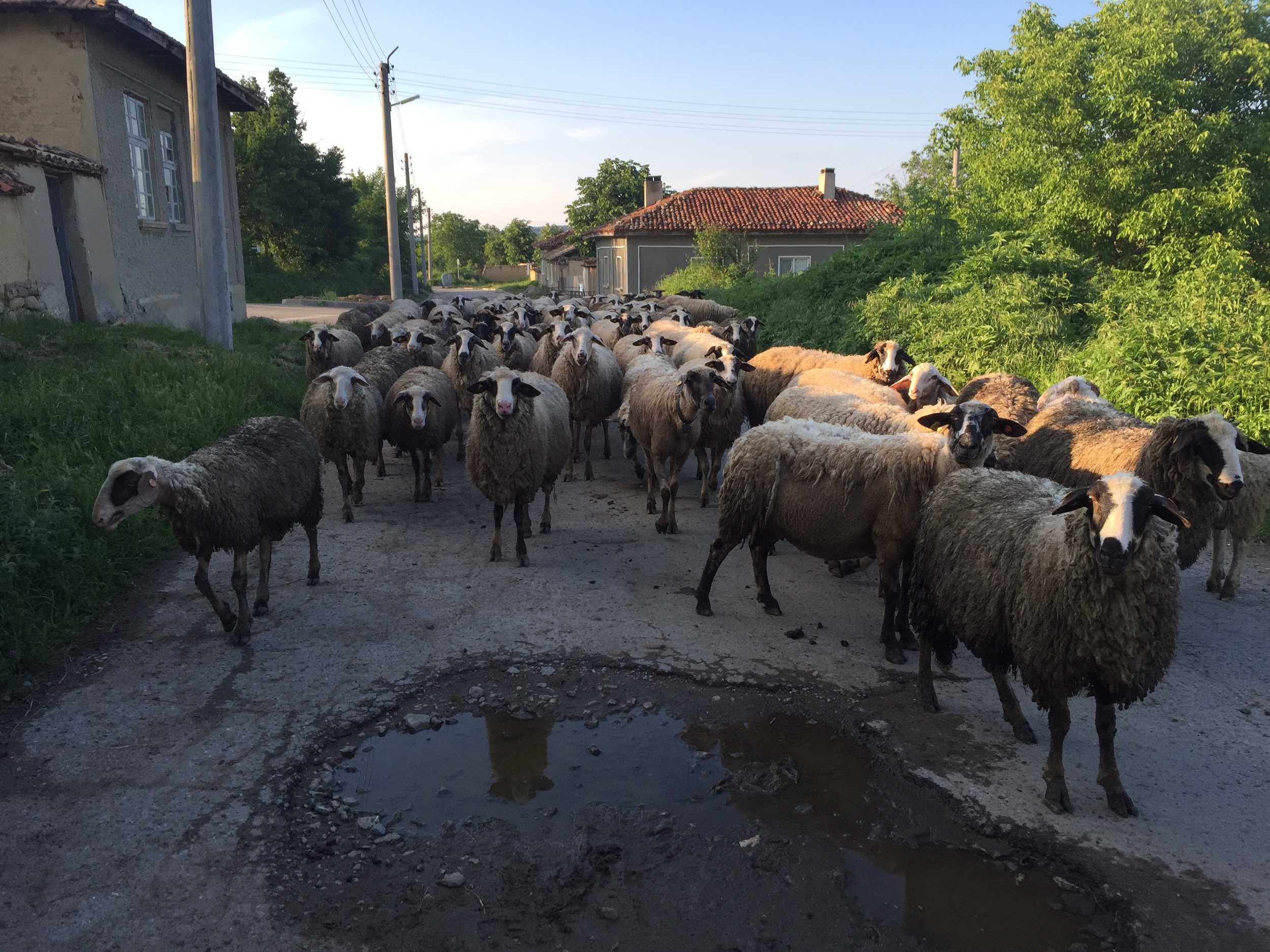
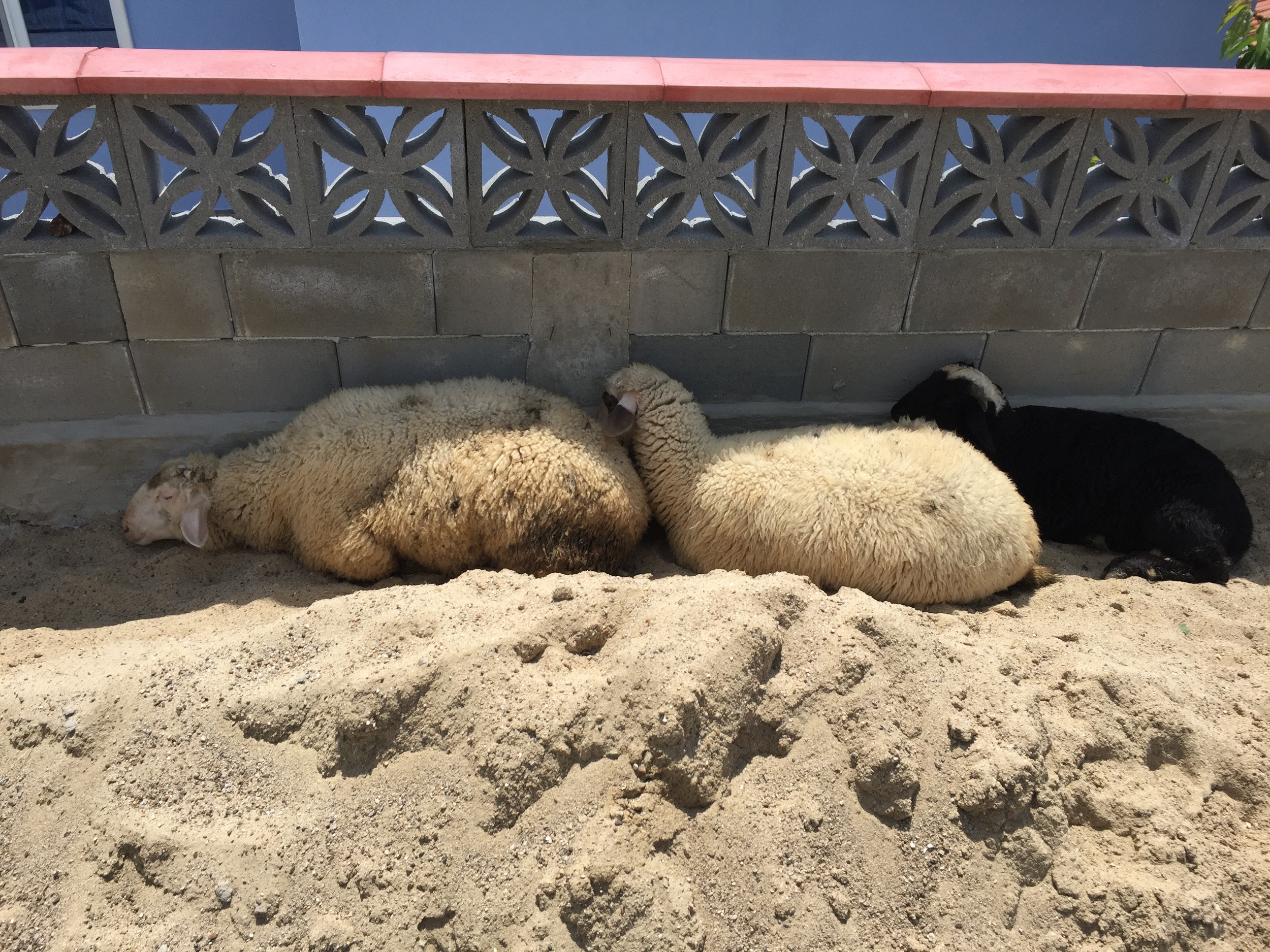
Being one with the herd.
Tradition states that a hiker is supposed to start near the Bulgarian capital at Kom Peak and then travel East to the Black Sea. The trail ends at Cape Emine, located in the small village Emona. In my case, I started in Istanbul and have been slowly making my way westward towards Portugal. Because of this, I am hiking the Kom-Emine backwards.
Hiking a trail backwards is common in the hiking community. Come to think of it, I don't know if it is possible to walk a trail "backwards". The trail is already there, you just happen to walk in a different direction. Unfortunately for those hiking the Kom-Emine, there is only one proper direction, and I am most certainly not following it.
The Kom-Emine is a long distance high-mountain trail pass that stretches over 700 kilometers (about 400 miles) in Bulgaria. You are essentially crossing the entire country along the Balkan mountains, and it is glorious. It is also one of the most perplexing and difficult trails that I've ever hiked, but I'll explain that later on in the post.
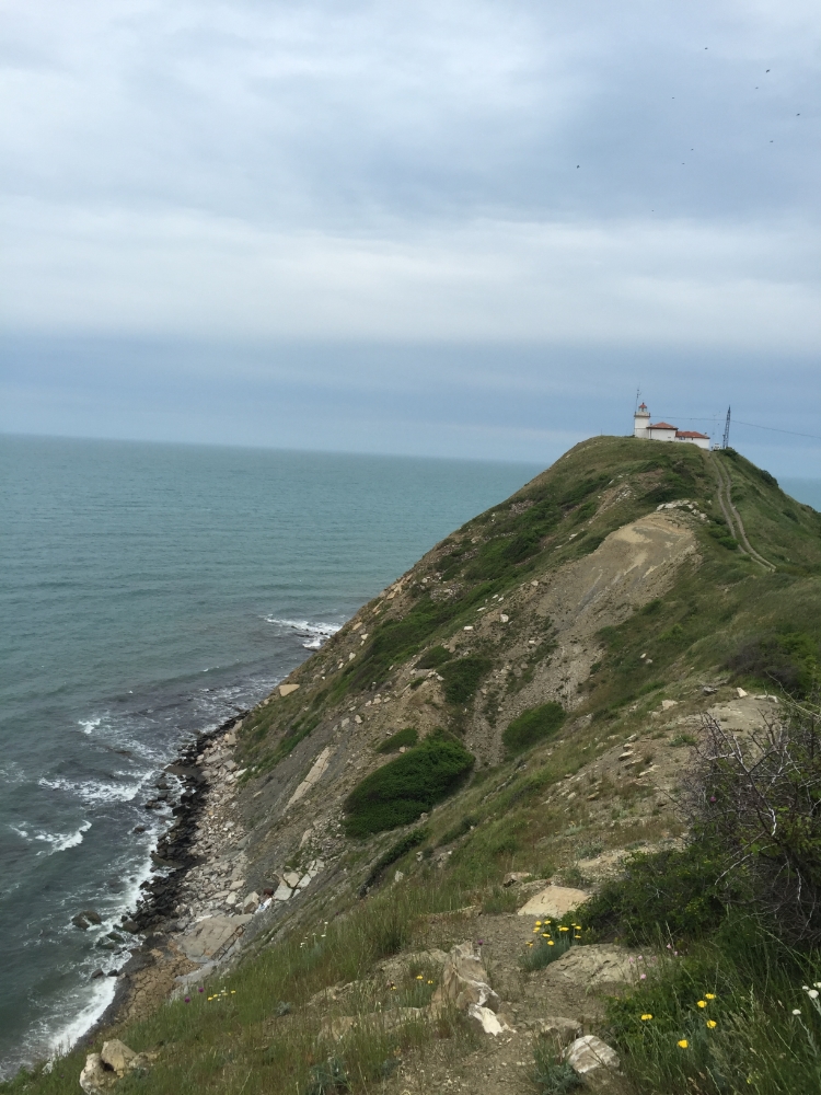
The lighthouse at Cape Emine
The trail was originally designed during the Communist era of Bulgarian history, and was at one point fairly popular. Because of the hiking tourism (as well as the Winter tourism), over 30 mountain huts, or khizhas, opened up to offer shelter and food for any wanderer with a few leva in their pocket. After the fall of communism, the trail has been left to its own devices. Many of the mountain huts have closed, and certain parts of the trail have been lost to the brush.
Certain Bulgarian hiking organizations have taken on the preservation of the Kom-Emine trail. Certain parts of the trail have been redirected, and there are typically painted markers or signs on trees that help you orientate your way across the Balkans. Unfortunately for people like myself, the trail signs and markers were organized for people walking towards the Black Sea rather than away from that beautiful body of water. So, if you are interested in hiking Emine-Kom, get ready to get lost.
Another one of the trail's cruel ironies is that while the western section of the trail is very well maintained with plenty of markers that will point you in the right direction, the eastern side is inconsistent, overgrown, and unintuitive. I've been told that many groups will hire a guide to help them navigate the trail, but I am a stubborn man with too small of a budget to afford that luxury.

I'm sure the reception is excellent out in these parts.
My method for navigating the trail was to download a free .gpx file that claimed to be the Kom-Emine route. As I've discovered, the route is a simplified version of the trail itself. The trail and my route occasionally match up, but it has only been on occasions. I have found myself leaving the free map multiple times and having to rely on compass and topographical navigation. It isn't anything that is overly technical, but be warned, don't put all of your faith in the free maps. It has helped me a great deal of the time, but it has led me astray.
You may be wondering, "Well Chris, if the .gpx file isn't completely accurate, why not buy a Bulgarian map of the trail?" I had thought of that and looked into finding a map of the trail, but every paper map I looked into became more and more of a disappointment. The maps generally show the trail as a squiggle rather than as an actual trail, and I've yet to find a paper map of the Kom-Emine that shows an accurate representation of the topography of the lands. They do show some major points, and the squiggle is generally correct, but it doesn't provide the kind of precision that I look for in a map. So, I've been following the markers as best as I can, and have, on many occasions, backtracked my steps or created my own route in order to get closer to my destination.
As I mentioned before, the trail itself is very inconsistent will thereby make you exhausted with confusion. I have followed well marked paths, muddy work roads, animal tracks, highways and have had to fight my way through brush. Because of the massive variation in trail types, is isn't wise to set any kind of expectations as to what you will be walking through. Some days will be easy jaunts, other days you will spend hours trying to find the trail. You may even run across old faded trail markers that lead you to the thickets and wildest parts of Bulgaria imaginable. I have lost the trail several times, and it isn't fun to be stuck in the middle of the forest on a mountain with little food and no water, I assure you of that.
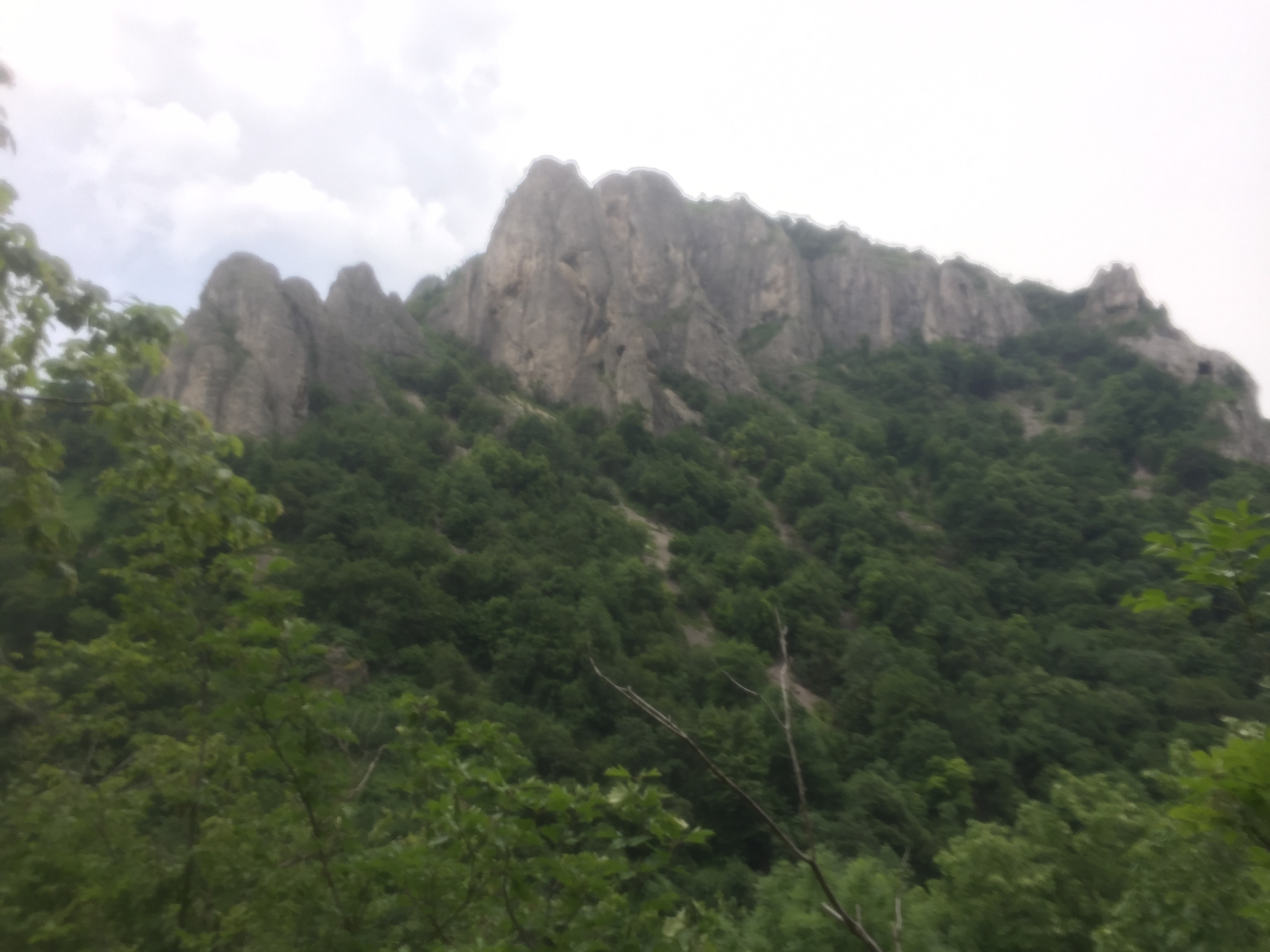
A view of some rocks. Unfortunately my camera lens was covered in sweat when I took this shot.
With all of its difficulties, the Kom-Emine sounds daunting, but it is so very much worth doing. The sights are amazing, the nature is profound, and I have never had so much fun taking on this type of challenge. You will meet amazingly hospitable people and will see a side of Bulgaria that is never mentioned in the media. This is an amazing country and a truly awesome adventure.
So, some quick notes about the trail:
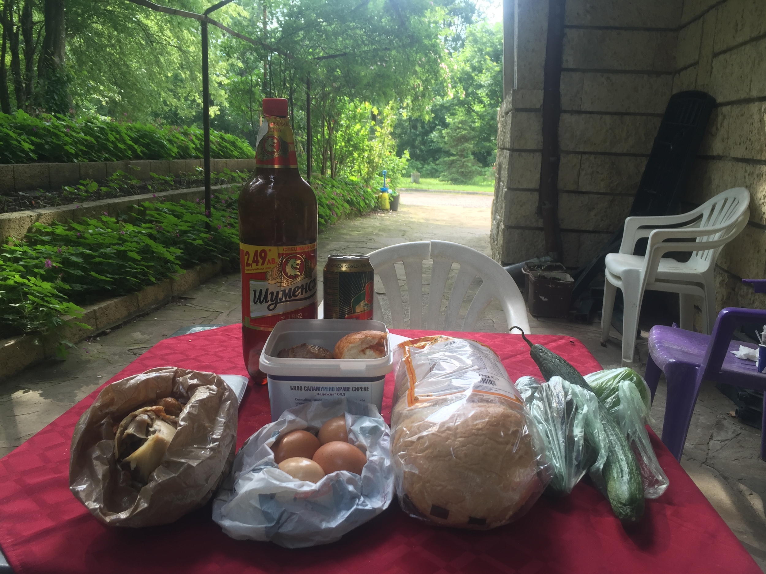
- Carry more water than you think you will need. There are plenty of wells along the route, but it isn't wise to expect to find a well everywhere you go. I've been lucky to find some unpolluted creek beds in the mountains, but I wouldn't trust the lower rivers. I've seen many a cow defecate into those waters, and you do not want to risk getting a diarrheal disease.
- You will pass through some small villages, but sometimes they can be few and far between, so be sure to stock up on supplies. It's better to have extra food or medical supplies than no food or medical supplies.
- Look out for the wildlife. There are hundreds of birds in these neck of the woods, and they are a sight to behold. I've heard coyotes howling in the night, gotten a little too close to a family of wild boar, seen a dead wolf pup, and have yet to spot a bear.
- Look into the season you plan to hike and prepare for the weather. I've been chatting with two German fellows who hiked Emine to Kom several weeks before me, and they have some chilling tales of fighting ice rain, blustery winds, and other unpleasantries. Most people typically hike the Kom Emine during the summer months. They prefer to avoid the muck and take on the brutal sunshine. I'm currently walking at the end of the rainy season, but I've been lucky with having mostly good hiking weather and the occasional downpour.
- The trail markers heading West are ridiculous. You'll see ten trail markers back to back on a straight road, then see nothing when you come to a fork in the road with four options. There are multiple work roads and cattle trails that intersect and interweave throughout the Kom-Emine, and you will more than likely not have a trail marker to help you find out with road to follow. Whenever I follow a new road or a new trail, I do my best to find any indication of a path people have been on. Whether it is a wood carving, some litter on the ground or some very faded paint on a tree, keep an eye out for it. It's really easy to lose the trail, and a pain in the butt to find it again.
Cool, now that I've given my little lesson on the Kom-Emine it is time to move on to some stories.
Tales from the trail: The First half of the kom-Emine
May 21, 2016
Because I am a stubborn individual, I decided to make my own way from the resort town Sunny Beach to the small village of Emona. After talking to a few locals, I was told that my original plan to hike along the highway from Sunny Beach to Emona was unnecessary. I would have had to deal with insane drivers, steep hills and little resources in order to circle around a mountain to get to the village. With the advice of the locals, I decided to make my own way along the Black Sea coast.
Alex and Mina
I ended up walking through, actually through, several fancy resorts to get to the rocky beach. From here I made my way along the rocky coastline by dodging freezing cold waves and dozens of large snakes. Because of the steep walls along the beach, I tried every opportunity to climb higher onto the ridge rather than below it. Several attempts were unsuccessful, but I eventually managed to find a small house at the edge of what was passable coastline. From here I climbed up the ridge, then spent the next several hours following dirt roads and cow trails. I eventually made it to Emona, a one saloon type of town, and celebrated with a beer.
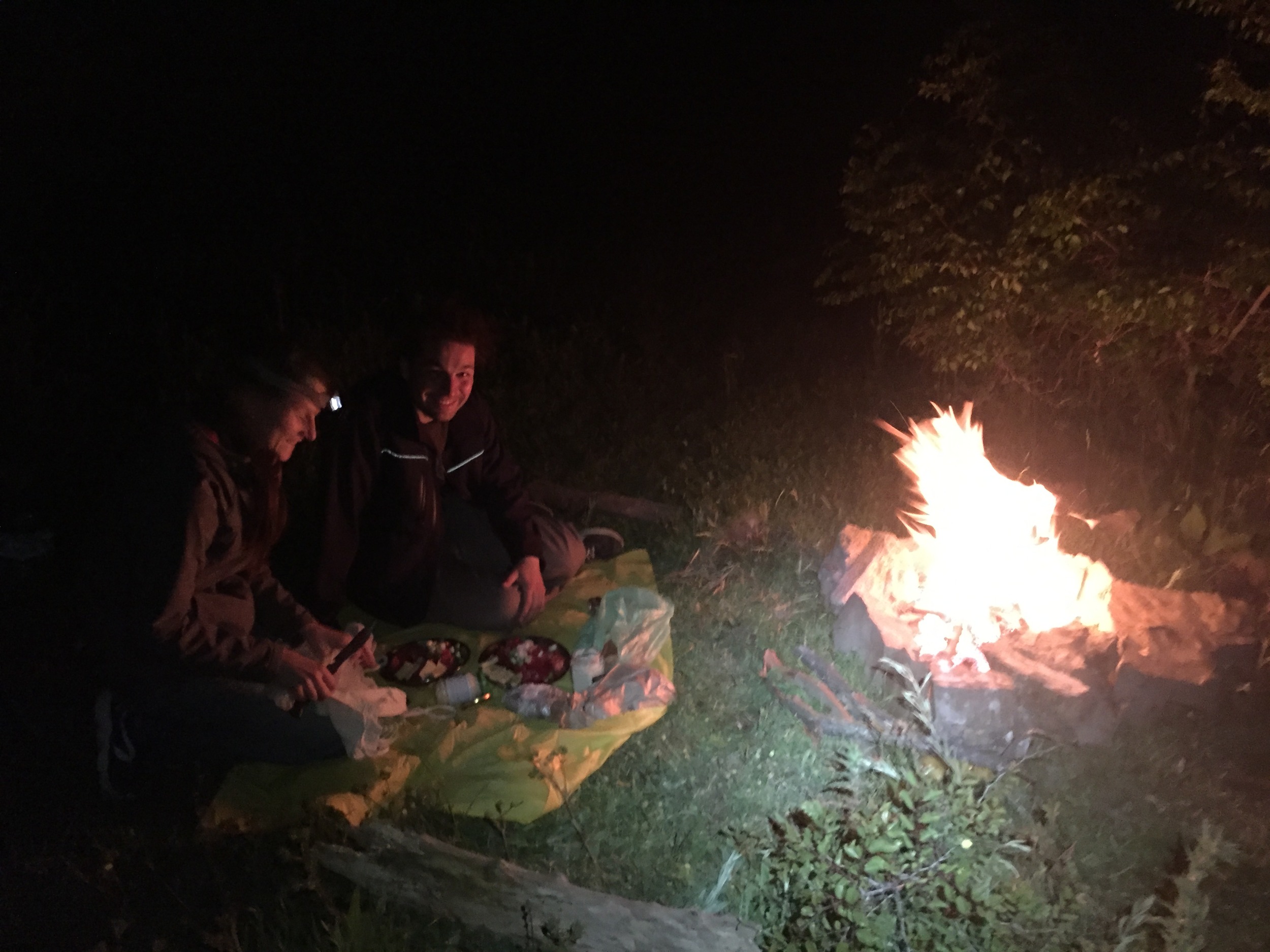
From here I made my way to Cape Emine, saw the lighthouse, and went about my way to set up camp. Lucky for me, a car drove up to me. Inside were two lovely Bulgarian adventurers, and they invited me to join them at their campsite. Their names are Mina and Alex, and, if you're curious to know more about them, check out my interview over on the "Sounds" page. We chatted all night, sat next to a wonderful fire, and dined on delicious bread and salad. Mina and Alex are wonderful people, and I hope to see them again.
May 22, 2016
Had my first day of proper Kom-Emine trail. The markers were pretty good here, pretty easy to spot for the most part. All of the warnings I had heard previously seemed unfounded, but I was to learn my lesson later on the trail. I ran into an Austrian hiking group who were amazed to hear my proposed hike. We chatted, they gifted me with food, and they took plenty of pictures.
A goat trying to butt in.
26 miles later, I was exhausted. According to a hiking itinerary that I found online, I should have found a village. At this point I was exhausted and running low on supplies. I checked my map and from what I understood, the village was still 8 miles away. At this point I hitched a ride to the village only to find out that I was in fact 3 miles away from where I had hitched. It was the road that was 8 miles long. After resupplying, I hiked back to where I had hitched, then set up camp. That night the weather was clear, so I slept under the stars. The full moon was incredibly bright, so it was difficult to fall asleep, but I managed.
May 23, 2016
After breaking camp I made my way to Topchiisko. When I entered the village I was surprised to hear Islamic prayer being played on the speakers of a shack of a mosque. When I asked the locals I learned that there are many Turkish villages in Bulgaria. They appear to be remnants from when the Ottoman Empire had taken hold of Bulgaria. I found the people to be interesting. Many were Muslims, but they ate pork and drank beer like a typical Bulgarian. I also discovered that Bulgarians in Turkish villages are incredibly friendly.
I met a gent who owned the local mountain hut, and he took me there via car. It is a rundown place, no luxuries here besides a roof and a bed, but for $4, I couldn't complain. I got a chance to talk to a Bulgarian family on vacation from Burgas, and we spent all night drinking vodka, sharing stories and chatting about life.
May 24, 2016
The owner of the hut was kind enough to lead me to the Kom-Emine trail, however he forgot to mention that I was going to be walking on a variation of the Kom-Emine. According to my .gpx route, I was way off target. But there were markers that said I was on the trail, so I followed the way until I got lost in a village. After chatting with the locals there, I received five different explanations as to where I should go. After an hour of looking around for a marker, a kind man took me in his car and drove me to the road I should have walked along. I never would have expected it, so I am incredibly grateful that he helped me, otherwise I would have been stuck for a lot longer.
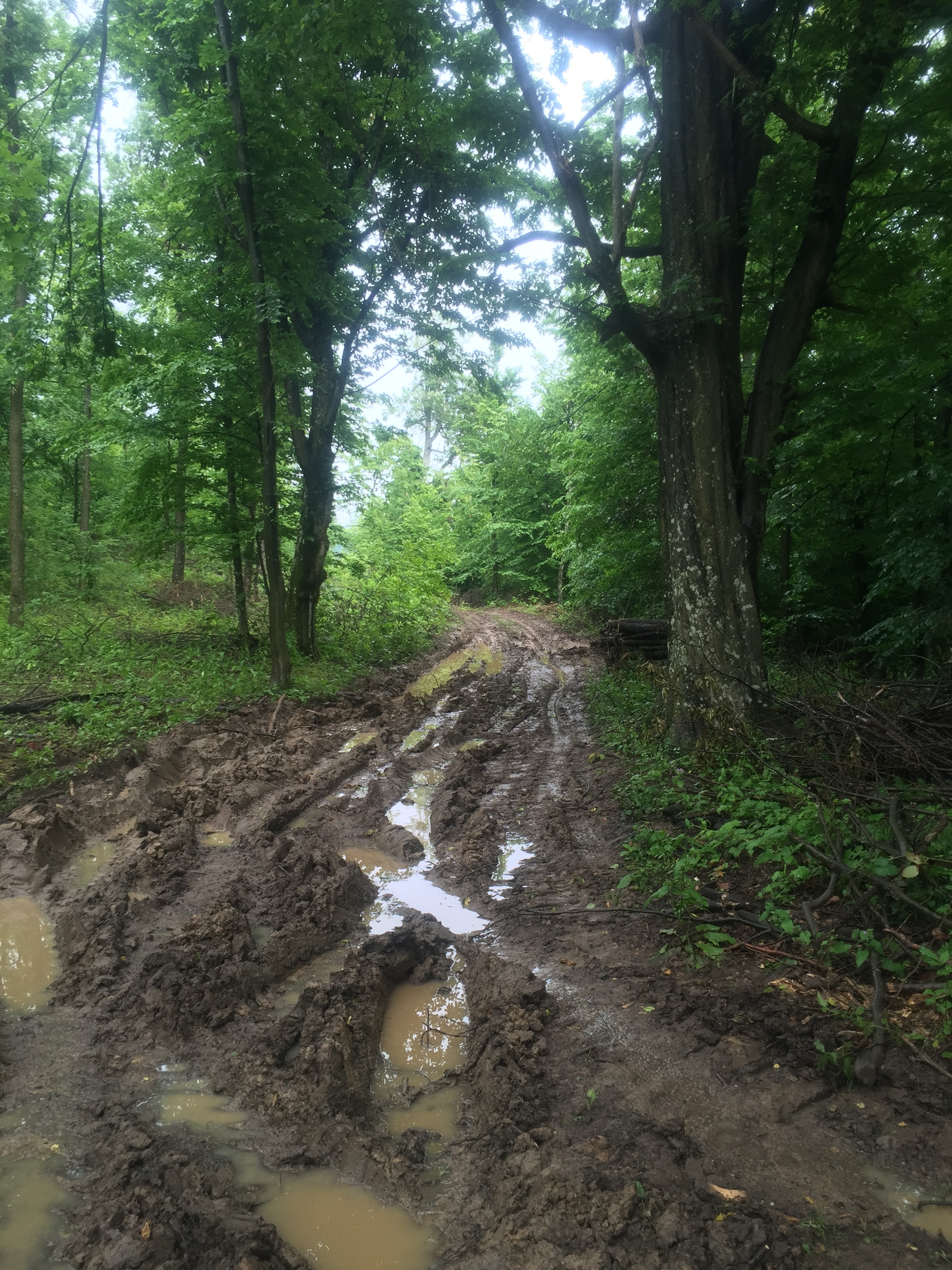
The "trail".
Eventually I made my way into where I thought I was going to find another mountain hut. Unfortunately every local had a different answer, so in my confusion, I took a ride from a guy who claimed to know where the hut was. Instead he drove me 20 kilometers away from the hut, so I had to hitch another ride to get back. Luck would have it, the second driver had a brother who spoke English, so I was able to find what I was looking for.
The hut was a new one, it wasn't technically open because it was still being renovated, but the family who owned the place were kind enough to let me stay and even offered me a discount. The family was incredibly sweet. One granddaughter spoke English, the other blew bubbles. For several hours I chatted, drank the Bulgarian moonshine rakia (awful stuff) and relaxed.
May 25, 2016
The rain finally caught up to me. After leaving the hut I made my way down the lonely road until I came to a mud covered hill. At this point I was walking in an absolute downpour. The trail markers took me to the mountain, but they didn't show me which of the several roads I was to take. Needless to say, there was a lot of soggy backtracking. At one point I had found a very, veeeery faded trail marker and followed the path. I ended up getting stuck in the middle of the woods for several hours. At this point my rain gear was soaked through. The brush had been pouring water down my hood, and I had accidentally left the pockets to my rain pants open. I was not a happy camper.
I eventually found my way to a marker and was ecstatic. Unfortunately the happiness was short lived, for I once again lost the trail. Hours were spent in utter confusion friends. Hours. When I finally escaped from the madness I met several woodsmen who told me that I could sleep at a mini hut. It was just a roof and a picnic table, but it was enough for me. I spent the night in the hammock shivering, but I was happy to be away from that damn mountain of mud.
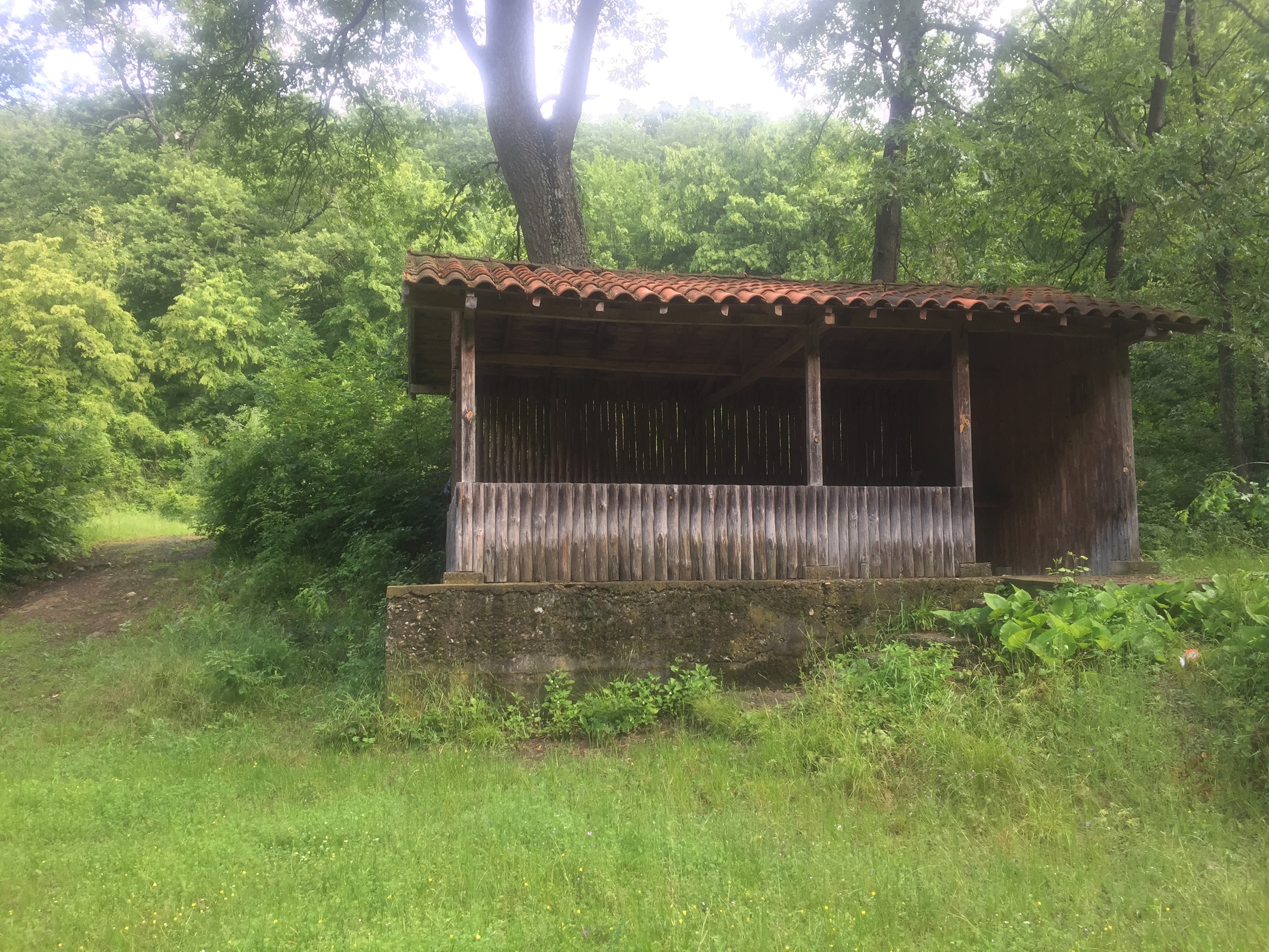
A "mini hut" that I slept in.
May 26, 2016
After drying my clothes as best as I could, I was off. Several hours later I found myself in a state of utter confusion. According to my .gpx file, I was supposed to travel North to the village Rish, then head straight West. The trail markers, however, had a different plan. They had me going Southeast, right back to where I had just been walking from. Because I couldn't understand the trail markers, I walked to Rish. Every local I asked was dumbfounded when I mentioned the Kom-Emine trail. Judging by the looks of the village, I wasn't going to find any hikers. Buildings were abandoned, roads left to be overcome by grass, a layer of grey surrounded the area.
One local claimed that he knew an Englishman living in the village, so he took me to meet him. The Englishman was James, a kind man with a wicked sense of humor. He's been living in the village Rish for 3 years now. He and his wife were working on building a home in the village, and it is still far from being finished. However, their renovations (and their garden!) looked incredible. Rather than be dilapidated, they were choosing to modernize their home as best as they could. James didn't know of the Kom-Emine trail, and when we tried to find it, he decided that I should just stay the night with him.
I ended up spending close to 48 hours with James. Of those 48 hours there was only 15 hours of silence, and that was because we were asleep. Spending 3 years in a foreign land lets the mind wander, so James' tongue was finally free when he met me. James taught me a lot about Bulgaria and Bulgarian culture. He also taught me how strange village life can be. In the 3 years he has been there, he's watched the village shrink from 3000 people to 300. Villages are disappearing, and the only folks left behind are the old, the alcoholic nincompoops, and the few families that want to try and revitalize their ancestor's homeland. A bizarre place indeed, but good lord was the scenery gorgeous.
May 31, 2016
James was kind enough to renovate a golf cart to hold my backpack, but unfortunately the golf cart fell apart after the first 3 mile (those 3 miles were pretty swell though). Ended up going through several villages, spoke Spanish to a Bulgarian, was gifted with more food, slept in a tin shed with the creepy crawlies, and made several attempts to get to Kotel. According to my .gpx route, I was only 20 miles away on May 28th. This was so very false. After the tin shed experience, I walked and I walked until I came to another camping resort getaway kind of place.
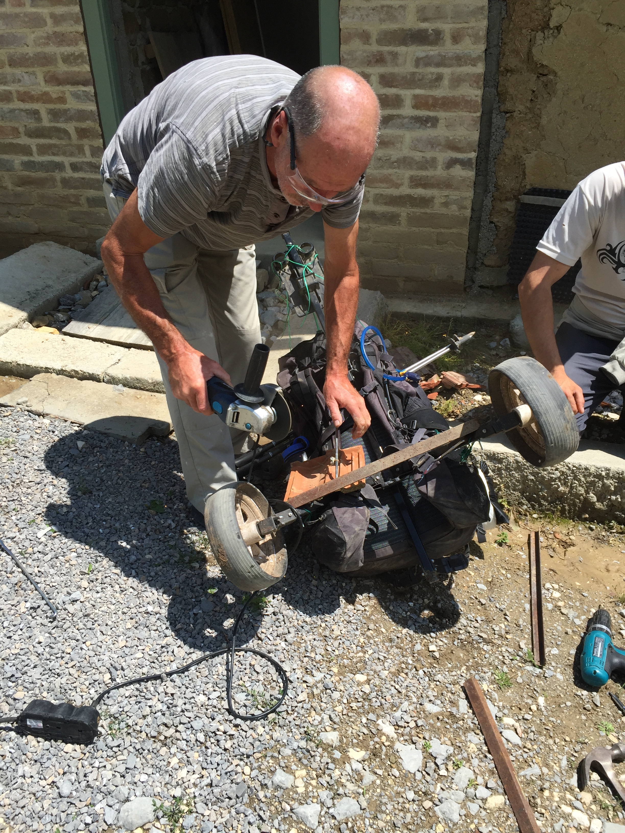
James and his golf cart
After drinking coffee, I followed some directions to get back on trail. They weren't the best directions. I spent several hours walking back and forth, and I was flustered. I eventually found a road that had one trail marker on it, but that was all. Several hours later, after exploring every work road I could find, I hung my head in defeat and walked back to the resort area. Here I met a party of Bulgarians who were finishing up their weekend getaway. They told me that it was foolish to follow these "outdated trails", and advised me to walk along the highways until I reached Kotel. They gifted me with several pounds of food and beer, then took me to a mountain hut.
The hut owners were incredibly nice people. They gave me the best duck soup I have ever had, chatted with me long into the night about Bulgarian history and communism, and I had a chance to hang out with Max, the cross-eyed Siberian Husky that stole my heart.
The next day I made my second attempt to get to Kotel. I followed the hut owner's directions and found myself on the same damn road with the one bloody trail marker. Due to frustration, I followed it. It turns out the road was leading me towards the right direction, so I was feeling comfortable with the idea of reaching Kotel. "It's only 10 miles away, and I have half of a day to get there, this is going to be easy!"
A wonderful feast that I was gifted.
Alas, 'twas not so. The road led me to another road, with led me to another. At this point I hadn't seen a marker for miles, so I started following my .gpx map. It did me well for the first several hours, but then it took me to where I hope to never go again. I entered a clearing that was covered in the carvings of generations. Initials with "1976" next to them, or "2001". I was confused: there was no trail, and all I saw was a creek bed. I tried following the carvings that matched my .gpx route, but that took me to a 20 meter waterfall. Because of the rocks, I almost tumbled off the cliff several times. Hours later I managed to get back to the clearing.
It was here that I noticed red lines painted on trees. The Kom-Emine trail marker is three horizontal stripes stacked one another: white-red-white. These lines, however, were just red. I began following the red lines and noticed bits and pieces of trash here and there. I also noticed more carvings. "Well, this is better than nothing".
It took me three hours to go one mile. The brush was intense, the bits and pieces of an old walking path were scattered, and I was tired with little water. After going down one of the steepest trails imaginable (the erosion and rain had turned it into a rocky slide), I popped out by a river. According to my map I was way off target, but I saw that I was 3 miles away from a village. After seeing several cows pollute the river with their waste, I knew that I had to go to town if I were to find any potable H2O.
At this point I had been walking for 11 hours. I was smelly, soaked after falling into the river, and so very, very tired. When I got to the village I saw a small cafe. The people there immediately began taking care of me. I was given water, led to the one hotel in town, and I had a chance to meet Daniel.

The woodcarvings that led the way.
Daniel is a Bulgarian expat who moved to the U.K. "There's no reason to stay in Bulgaria now" he said. "There's nothing here for young people that can help us get a better life". Daniel introduced me to his mates, and we ended up staying out until 2:00 drinking laughing, and me being scared to death by Daniel's friend's driving. Apparently a 40 km zone really means 100 kms... Overall it was a happy accident to meet these folks. There's some type of camaraderie that exists between men of similar ages, regardless of nationality. I didn't realize that I miss being around 20-something year-olds, but Daniel and his pals helped show me the light. I hope all is well with Daniel and his mates. Maybe we'll cross paths someday in the future...
The next day I finally made it to Kotel. This time I stuck to the highways and avoided returning back to the mess that is that section of the Kom-Emine. Kotel was for the most part closed down by the time I arrived. The weather wasn't great, so the largest town I've been in for the past several weeks felt incredibly small. That night I ate some pizza, found the one place with a bed that was still open, and called it a night.
June 2, 2016
Getting to Kotel was difficult, but leaving Kotel was even worse. I was fairly excited to be leaving Kotel: there were supposed to be better trail markers, plus I was getting closer and closer to being halfway through Bulgaria. The morning I left I felt strong. The markers led me out of town to go climb a mountain. The markers at this point were very helpful. Every so often I would lose track of the faded markers, but I was able to find the next marker with little effort.
The mountain was tough; Bulgarian trails don't believe in switchbacks so it is either straight up or straight down. Two-calves-burning hours later, I made it to the top. At this point the markers disappeared. So there I was, on top of a mountain with little sense of direction. I decided to follow my way to where my route recommended, but that proved to be incredibly difficult. I followed work roads, got stuck in the mud, and ran out of water. At this point I started yelling to see if anyone was near me. In response to my yells, I heard a boisterous "MOOOO". I followed the call of the bovine. "Cows like water," I thought. "I need to find these cows."
I soon found the pasture and crossed over the electrical fence. I eventually began following a trickle of water until I found a well. I have never drank so heartily in all of my days. The cows were nervous to see me, but they soon joined me in my celebration. My hands cupped what they could, and the cows lapped as much as their mouths would allow.
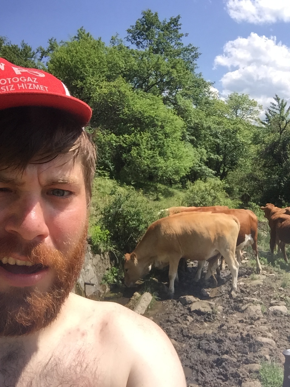
Drinking with the cows.
After I had my fill (and filled up my containers) I headed out towards the route. It wasn't a great idea. Every hill turned into a steep battle, so climbing down was treacherous, and climbing up was miserable. I eventually ran into a cow herder who looked at me in disbelief. There was no reason for me to be there, and there was no easy way to get out. He pointed me back towards Kotel, but that would mean that I would have to scale several mounds in the process. I headed out towards the village.
After falling into cow patties, getting attacked by ticks and having my legs go numb from the stinging nettles, I came across a dry creek. I figured that the creek would be easier to follow compared to scaling another mound, so I walked and I walked. I spent close to an hour in that damn creek. I swam through parasite-ridden pools, walked along rotting logs as though they were balancing beams, and nearly damaged my legs on multiple occasions. This was the lowest moment by far. Smelling of cow poop, being covered in ticks, and still not in town, I grew anxious.
But lo! There was the sound of a car driving by. And what ho! There was a road! The most beautiful gravel road you have ever seen! When I emerged from that blasted creek I wept with joy. I was tired and hungry, but I knew that the day was almost over. I soon made my way to a little bed and breakfast, and proceeded to engorge myself on as much food as I could stuff in me.
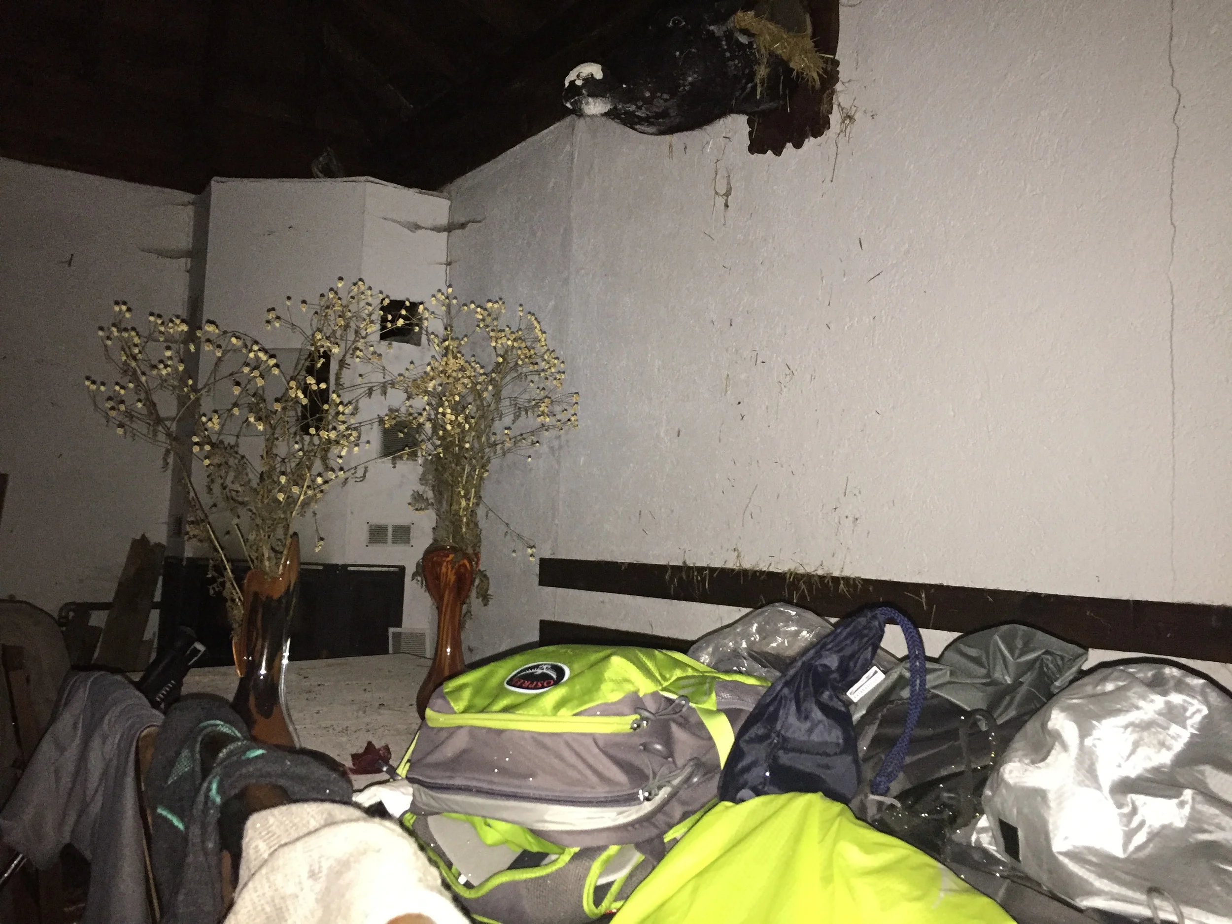
After spending a night with the bedbugs, I was on my way. I chose to follow my gpx route. It wasn't the proper trail, but it led me to the trail. From here I walked until dark. I popped out by a mountain hut, but alas, it was closed and long since abandoned. Across the road was a small building. I explored a bit and found that the front door was open. When inside, I saw that a side window had been left ajar. It was dark, moldy, and covered in roaches. But it was a mostly safe place to sleep, so I turned that horrid bar into my home for the night. All night I could hear the rats scratching away. The punks even stole my peanuts.
After two nights of little sleep, I was happy to find somewhere else to go for the night.
Home for the night. Just imagine this as being pitch black.
June 5, 2016
After dealing with the rats, I decided to find a proper hut to sleep in. The next hut, right next to the Chumerna Peak, was a pleasant one. There were three puppies lounging about, and the gal that was managing the place was kind enough to make me a meal. I spent that day drying out from rain, reading Joyce's Ulysses and hanging out with the pups.
The next morning I spent several hours walking in the thickest of mists. Sometime around noon I ran into several Bulgarian woodsmen. It turns out that it was a Bulgarian holiday of sorts, so the guys were cleaning up their national parks. I was soon invited to stay for lunch. At lunch everyone was curious to know more about this odd California man. They also kept serving me copious amounts of moonshine. When I tried to explain that I still had to walk another 6 hours to get to my next destination, they scoffed and told me that I was being hijacked. They simply would not let me leave until I had danced, played terrible guitar, and sang improvisational songs. At that point it was much too late to walk, but I didn't mind. It was a grand night indeed. The folks there were incredibly friendly, and they let me sleep at the hut for free.
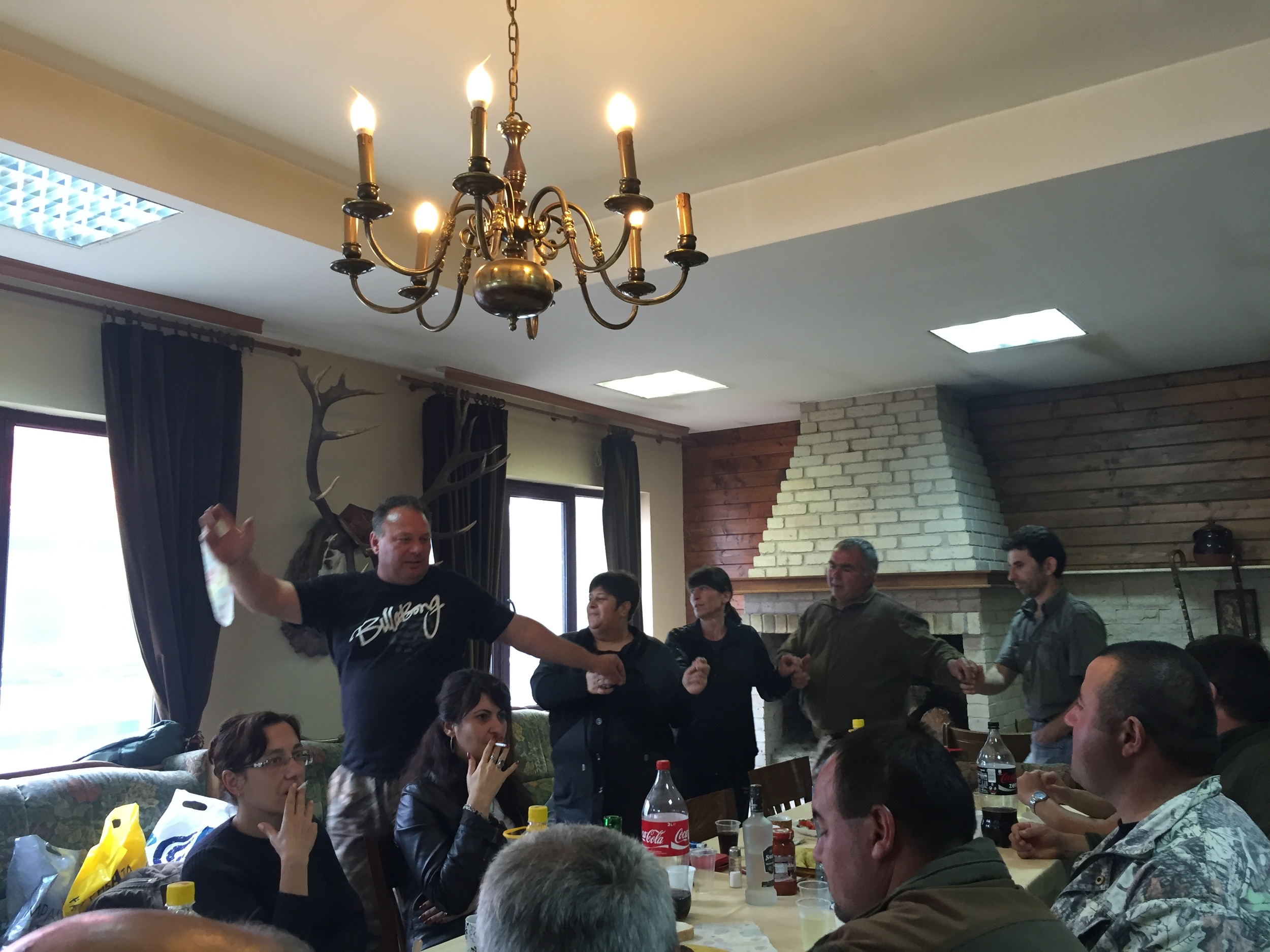
Dancing the day away with the woodsmen.
June 7, 2016
After another day of walking and another hut, I eventually made my way to the epic monument that is Buzludzha. My left leg began to develop shin splints, so I was only able to hobble the last kilometer. Seeing the monument was amazing. As the photos show, it is a tremendously large building that is in the shape of a UFO. A bizarre sight indeed. Inside the building is the decaying art of the communist party, which was beautiful in an odd way. It's a shame that the monument is just left to decay, but I suppose Bulgaria doesn't want to be reminded of its past.

Buzludzha looks like something out of a James Bond movie.
I was fortunate to find a lone car at the monument. Inside was a Bulgarian girl that had just come back from studying abroad in the U.K. She told me that I was near a hut, so I started to walk. At this point the weather became awful. Just as I was walking away, the Bulgarian girl's friends exited the monument. "Do you want a ride?" They asked. "Sure!" I replied. "Do you want to hang out with us tonight?" one of them said. "Why not!"
So I spent that evening hanging out with three delightful Bulgarian college students. We chatted about life, played cards, and I was able to try a typical Bulgarian meal. It is similar to a quiche in some ways. It consists of layers of dough, yoghurt and cheese. Very tasty and sinful indeed.
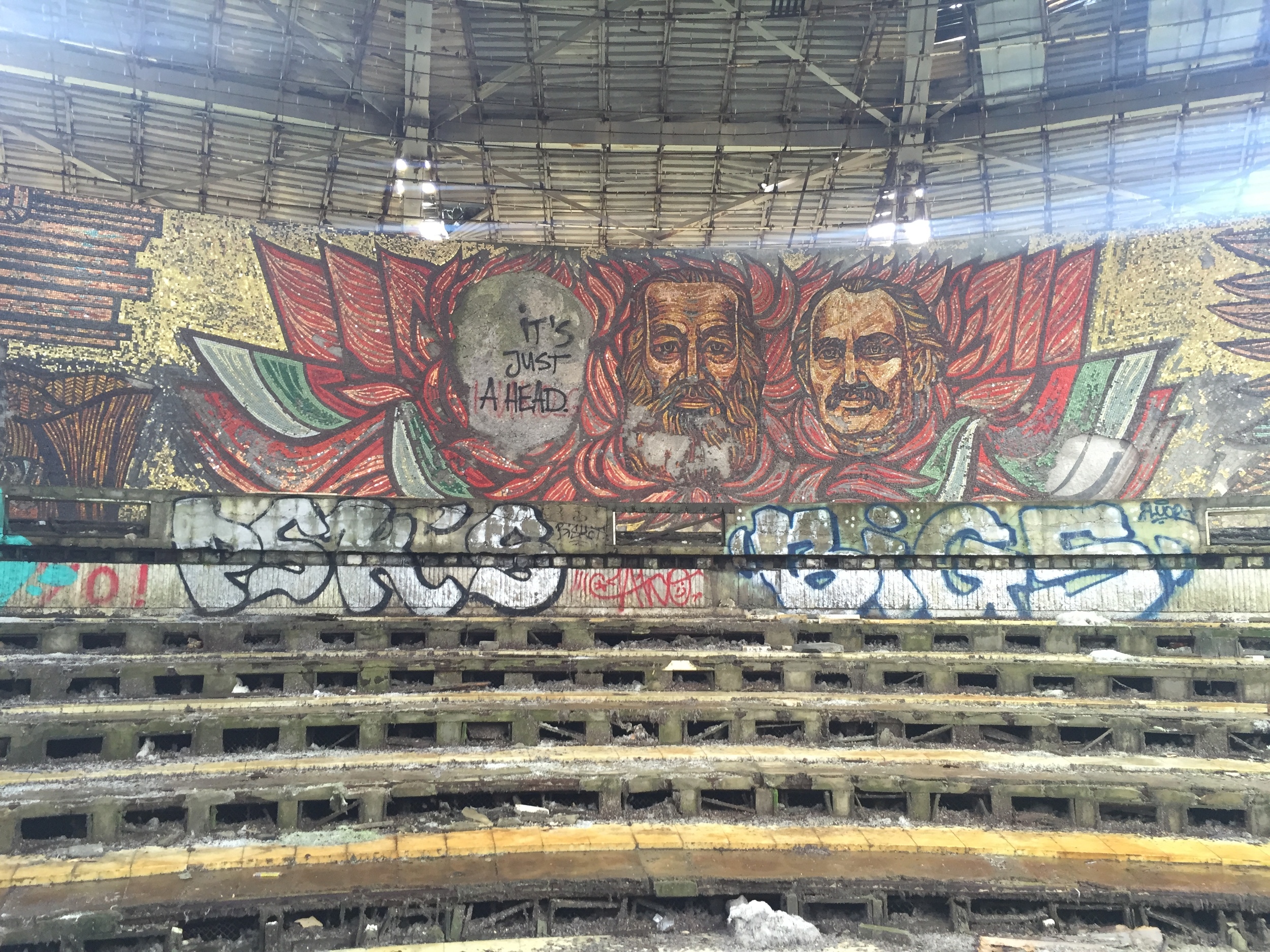
Inside the UFO.
Yesterday morning I hitched my way back to the monument. My shin splint is still bothering me, so I've spent yesterday and today resting up. Tomorrow begins the second half of the trail, and I cannot wait to get back to hiking. It's becoming more and more difficult to just sit and relax. Sitting for a day is making me antsy, but I know that my body needs a bit of a break.
Thanks again for sticking with me, I hope that you've found my journal entries to be entertaining. I hope that all is well, and I can't wait to tell you more about the journey.
Cheers!
I had to leave my mark.